SPATIAL STRATEGY, DEVELOPMENT AND URBAN SYSTEMS
(StraPlan Lab)
StraSpace delivers evidence-based spatial solutions at all scales for regional development, urban growth, disaster risk reduction, and mobility planning.
Through advanced spatial analyses, comprehensive datasets, and interdisciplinary expertise, StraSpace develops implementable visions, scenarios, and spatial decisions tailored to each region and city.
Regional Development Plans
StraSpace analyses regional socio-economic structures through a holistic perspective, identifying each region’s unique development potential.
Assessments supported by demographic and economic trend analysis, advanced spatial analytics, and field studies clearly define regional strengths, vulnerabilities, and priority needs. Based on these findings, realistic regional visions, measurable objectives, and strategic directions are developed.
Regional plans prepared by StraSpace include implementable policies, concrete spatial decisions, and prioritized action packages, fully aligned with sustainable development goals, national development objectives, upper-scale plans, and sectoral strategies.
Integrated Urban Development Strategies
StraSpace adopts a comprehensive approach to cities, conducting in-depth, data-driven analyses of key urban components—including social and economic structures, spatial morphology, transport networks, disaster risks, and climate change—supported by fieldwork and indicators.
Building on this strong analytical foundation, StraSpace develops thematic strategies shaping the future of cities, including:
• Urban identity and social inclusion
• Competitive economic development and climate-resilient urbanization
• Accessible mobility for all and continuous ecological corridors
For focus neighborhoods and sub-areas, StraSpace produces alternative development scenarios and prepares corresponding spatial visions, urban design guidelines, and prioritized project portfolios.
Disaster Risk Reduction and Mitigation Master Plans
StraSpace conducts comprehensive multi-hazard analyses to enhance settlement resilience against earthquakes, floods, flash floods, and wildfires. Hazard maps are produced by assessing the probability, intensity, and spatial extent of each hazard, while vulnerability maps are developed through analyses of building stock, population, and infrastructure. Risk levels are calculated by integrating hazard and vulnerability layers, enabling the identification of critical risk areas.
Based on these analyses, StraSpace:
• Develops risk-reduction–oriented, area-based intervention projects
• Prepares phased intervention programs, climate-adaptive and nature-based mitigation strategies aligned with hazard and vulnerability levels
• Guides decisions on strengthening and transformation priorities, post-disaster open and green space use, and the designation of safe settlement areas
All strategies are translated into implementable action plans aligned with investment priorities and budget frameworks.
Transport Planning and Sustainable Urban Mobility Plans
StraSpace analyses transport systems at national, regional, and urban scales using comprehensive datasets derived from:
• Mobility data obtained from digital navigation platforms
• Anonymized mobile phone signal data
• Network performance and speed–density indicators
• Vehicle counts, toll data, and public transport operation data
• Where necessary, on-site counts, observations, and tailored methodological studies
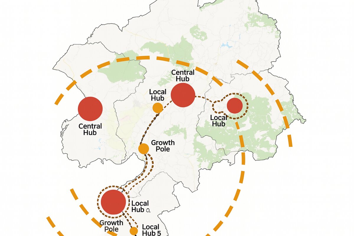
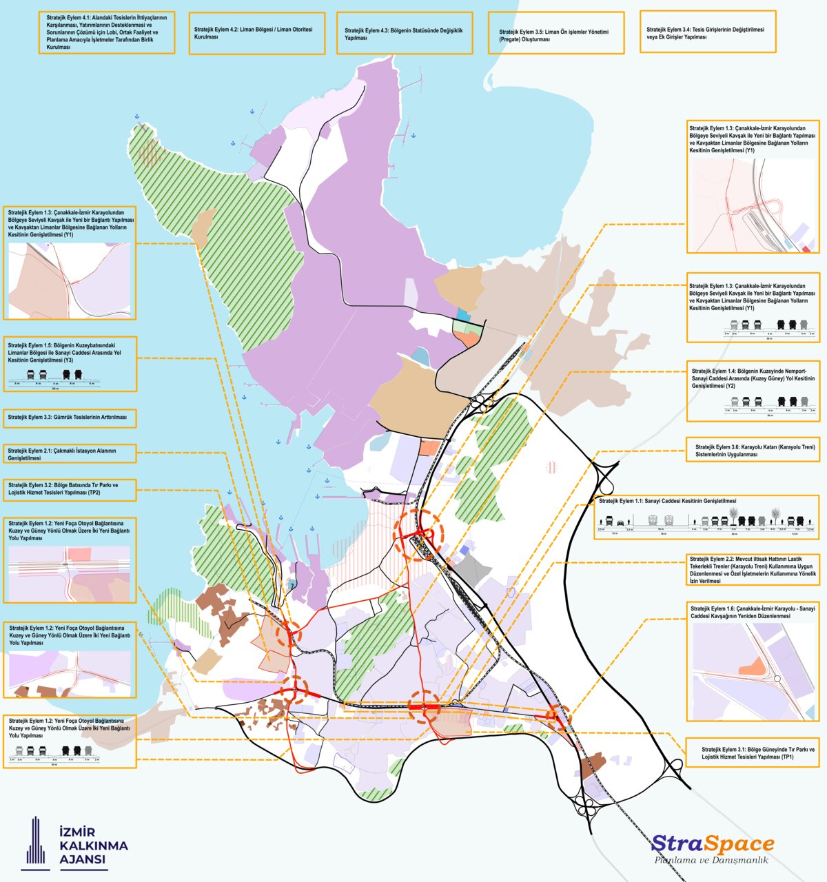
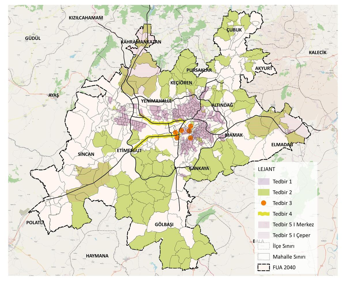
At national and regional scales, main transport corridors, logistics flows, and intermodal connections are analysed to develop modal strategies, network frameworks, and investment priorities.
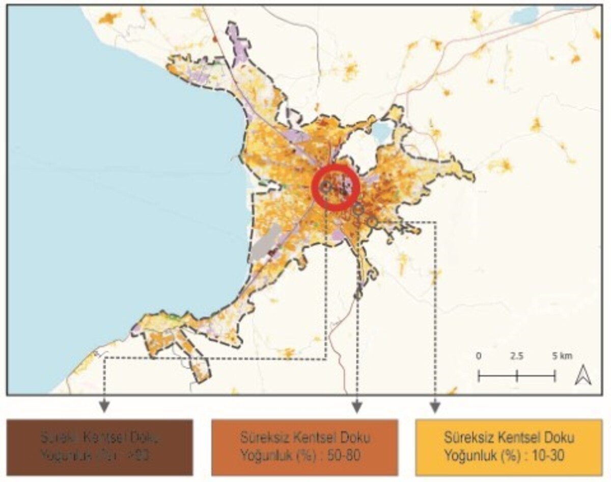
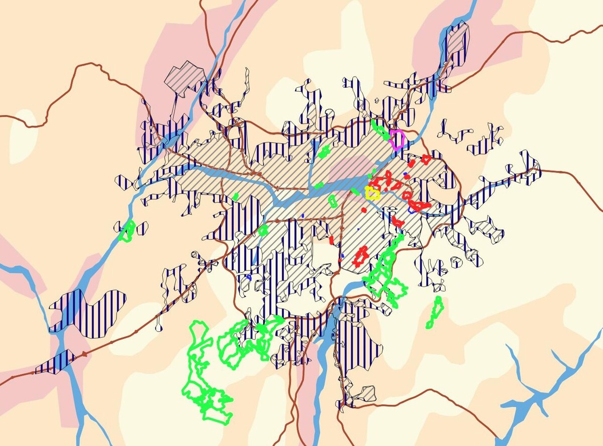
At the urban scale, public transport performance, accessibility, pedestrian and cycling infrastructure, and environmental impacts are assessed to produce sustainable mobility solutions, intelligent transport applications, and traffic safety strategies. Area-based design decisions, priority corridors, Transit-Oriented Development (TOD) areas, and network plans further strengthen implementation.
Urban Spatial Planning: Master Plans and Detailed Master Plans
StraSpace, kentlerin mekânsal gelişimini yönlendiren master ve detaylı master planlar üretir. Master planlarda arazi kullanım kararları, büyüme senaryoları, ekolojik ağlar, ana ulaşım omurgası, sosyal donatı şeması ve mekânsal analizler bütüncül bir çerçevede ele alınır.
Detaylı master planlarda ise blok ve fonksiyon bazlı kullanım kararları, yoğunluklar, yapılaşma koşulları, açık–yeşil alan standartları, erişilebilirlik, dönüşüm alanları ve uygulama programını yönlendiren mekânsal çerçeveler geliştirilir.
SERVICES
CONTACT